
Recommended
More Related Content
What's hot
What's hot (20)
Similar to Flood Alleviation Scheme Banbury
Similar to Flood Alleviation Scheme Banbury (20)
Recently uploaded
Recently uploaded (20)
Flood Alleviation Scheme Banbury
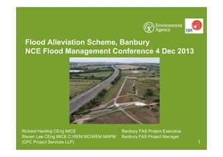
- 1. Flood Alleviation Scheme, Banbury NCE Flood Management Conference 4 Dec 2013 Richard Harding CEng MICE Steven Lee CEng MICE C.WEM MCIWEM MAPM (CPC Project Services LLP) Banbury FAS Project Executive Banbury FAS Project Manager 1
- 2. Banbury FAS: Background Banbury has a long history of flooding. In April 1998 125 residential & 35 commercial properties were flooded causing over £12.5m of damage – the flood was estimated as a 1:100 year event. The newly constructed scheme protects Banbury against a 1:200 year fluvial flood reducing the risk of flooding to 441 residential and 73 commercial properties bringing benefits of c.£100m. Total scheme cost c.£18.6m. The scheme has been funded by the Thames Regional Flood & Coastal Committee and 3rd party contributions of over £3m from Cherwell DC, Thames Water, Network Rail and Prodrive. 2
- 3. Banbury FAS: Options Historic flood review Spiceball gauging station records Historic record review Rainfall hydrographs Options included do nothing/maintain improve conveyance local defences diversion channel/tunnel upstream flood storage 3
- 4. Banbury FAS: Key facts The main upstream embankment is 2.85km long with a maximum height of 4.5m. The flood storage area created behind the embankment is capable of holding over 3million m3 of flood water in a 1:200yr event equivalent to 1200 Olympic size swimming pools. Over 200,000m3 of material was dug from the field on the opposite side of the canal to construct the embankment. The 2 flow control structures are identical, contain no moving parts and incorporate the main spillways. We also raised a 860m long section of the A361 to ensure it floods no more frequently than at present. At Wildmere we have constructed a 400m long earth embankment: at Tramways we have built a combination of earth embankments and low level sheet pile walls whilst at Moorfield Brook we had previously constructed a pumping station. 4
- 5. Banbury FAS: Layout plan 5
- 6. Banbury FAS: Design challenges Client brief – simple, passive system. Legal advice was to negotiate alongside a CPO. First CPO was issued in 2004 using ISIS model. Objections received from both landowners and statutory consultees – took several years to resolve statutory objections. Changes in government priority scoring system in 2006 meant scheme wasn’t funded. Public Inquiry was cancelled at our request as certainty of funding is a prerequisite. Funding constraints - alternate funding sources/partnership funding confirmed. New CPO issued in 2007 using new modelling (Tuflow). Objections again received plus 3 subsequent CPO amendments needed. Public Inquiry in May 2010. Decision on 31 Oct 2010. Last possible day for 2011 start on site. Impact on clearance and mobilisation. Climate change. Managing public expectations/interest throughout. 6
- 7. Banbury FAS: Material win areas Reviewed 8 potential local win areas – generally ‘raised areas’ upstream of Banbury We clearly weren’t the first to recognise their potential as extensive archaeology remains and now many vital as cattle refuges in flood events Archaeology included Bronze Age settlement patterns, British Romano farmstead settlements with Saxon farmsteads overlaying these. Medieval ridge and furrow agricultural field patterns throughout the area Within the Cropredy Bridge Battlefield site from the English Civil War. But key issue was 2nd World War anti-aircraft battery! 7
- 8. Banbury FAS: Ideal design of control structure • Flow control structure should throttle river flows to 38m3/s • Control of discharge should be automatic (no attendance) • No reliance on power supplies or remote operation • No moving parts • Minimised impact on upstream landowners 8
- 9. Banbury FAS: Design innovation: double-baffle orifice • Uniquely adapted from irrigation schemes • Described in textbooks • Never before used in UK Double-baffle orifice layout and performance (after Bos, 1989) Battery of double-baffle orifice devices (Neyrpic, 1971) 9
- 10. Banbury FAS: Double-baffle orifice design – how it works Low head, with crump weir controlling the flow Medium head, with flow controlled by the upstream baffle High head, with flow controlled by the downstream baffle 10
- 11. Banbury FAS: Model testing The graph shows the resulting rating curve for each flow control structure Head Design developed by physical model testing at HR Wallingford Flow 11
- 12. Banbury FAS: Benefits of innovative design • • • • • • • • • Simple design Passes constant flow Increased reliability (no moving parts) Increased life of asset Reduced operation & maintenance costs Requires no operation during flood Increased sustainability (no energy requirements) Reduced capital costs Reduced carbon footprint over the life of the asset All benefits of passive design 12
- 15. Banbury FAS: Challenges Availability of material Archaeology Working in four locations Landowner requirements Minimising winter working Minimising waste – 97% recycling A361 amendments to road width Cropredy Festival Managing local expectations 15
- 16. Banbury FAS: Flood storage reservoir borrow pit Main Borrow Pit located West side of Oxford Canal Clay from Borrow Pit suitable for Embankment Pre-Construction anticipated using Weathered ‘Brown’ Clay Selection Found to be difficult + rock lenses During Construction Unweathered ‘Blue Clay’ found to be Suitable . 16
- 17. Banbury FAS: Archaeology Pre-historic flint tool finds in the RA6 Bronze Age settlement patterns British Romano farmstead settlements Saxon farmsteads overlying the British Romano settlements Medieval ridge and furrow agricultural field patterns Within the Cropredy Bridge Battlefield site from the English Civil War. Dummy 2nd World War anti-aircraft battery . 17
- 18. Banbury FAS: Reservoir Embankment construction photographs 18
- 19. Banbury FAS: Flow control structures construction photographs 19
- 20. Banbury FAS: River realignments construction photographs 20
- 21. Banbury FAS: A361 Road Raising 860m of existing road raised to ensure flooding and road closure no more frequent than existing Culverts installed to ensure balanced water levels either side of road during flood events Two local authority boundaries 21
- 22. Banbury FAS: A361 Road Raising - Construction 22
- 23. Banbury FAS: Tramways Protects Industrial Estate & Football Ground from Flooding 210m Long Sheet Pile Walls with Concrete Capping Beam 100m Long Earth Embankment 2m High 24
- 24. Banbury FAS: Tramways - Construction 24
- 25. Banbury FAS: Wildmere Protects Industrial Estate from Flooding 400m of Earth Embankment up to 2m high 2 No. Culverts 25
- 26. Banbury FAS: Wildmere - Construction 26
- 27. Banbury FAS: Wider scheme benefits Proposed Country Park in win area, working with Cherwell DC 12 hectares of new BAP habitat including wet and dry woodland/scrub planting 3 river realignments incorporating new ponds New hedgerows and trees (planting 3 times more than were cut down) New & reinstated meadows Improved footpath access 27
- 28. Banbury FAS: Scheme in operation – November 2012 28
- 29. Banbury FAS: Aerial view of the completed embankment Richard.Harding@environment-agency.gov.uk Steven.Lee@cpcprojectservices.com 29