CarFree Coast of Maine
•
1 like•801 views

A proposal for a Car-Free transportation alternative up the Maine coast as far as Acadia National Park

Recommended
Recommended
More Related Content
What's hot
Viewers also liked
Viewers also liked (8)
Similar to CarFree Coast of Maine
Similar to CarFree Coast of Maine (20)
More from Harpswell Coastal Academy
More from Harpswell Coastal Academy (11)
Recently uploaded
Recently uploaded (20)
CarFree Coast of Maine
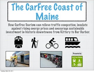
- 1. The CarFree Coast of Maine How CarFree Tourism can relieve traffic congestion, insulate against rising energy prices and encourage sustainable investment in historic downtowns from Kittery to Bar Harbor. Presented by Tuesday, March 29, 2011
- 2. Possible Car-Free routing to Acadia N.P DOWNEASTER 2012 MAINE EASTERN R.R. FERRY CONNECTION Tuesday, March 29, 2011
- 3. Current Downeaster Route Downeaster Extension 2012 Current Maine Eastern Route Current Maine State Ferry Routes (VinalHaven, North Haven, Swan’s Island) Proposed Car-Free Link Tuesday, March 29, 2011
- 4. The Maine Coast CarFree Corridor The Maine Coast CarFree Corridor would include communities along the current Downeaster route, but would also add Freeport, Brunswick, midcoast communities along the Rockland Branch as well island communities around Acadia. Car Free Corridor Communities Portland MT. Desert Island Old Orchard Beach Bass HarborSwan’s Island Maine Downtown Network Saco-Biddeford North Haven/Vinal Haven Communities Wells Rockland Dover Damariscotta Saco/Biddeford Durham Wiscasset Brunswick Exeter Bath Bath Haverhill Brunswick Damariscotta Boston Freeport Rockland Tuesday, March 29, 2011
- 5. What Is CarFree Travel? In most cases Car-Free Travel simply means getting from place to place without a car. However, recent concern over fossil fuel consumption has led some Sustainable Tourism advocates to include CarFree travel alternatives as key components of sustainability. The car-free movement is a broad, informal, emergent network of individuals and organizations including social activists, urban planners and others brought together by a shared belief that cars are too dominant in most modern cities. The goal of the movement is to create places where car use is greatly reduced or eliminated, to convert road and parking space to other public uses and to rebuild compact urban environments where most destinations are within easy reach by public transport, walking, or cycling http://en.wikipedia.org/wiki/Car-free_movement Sustainable tourism is tourism attempting to make a low impact on the environment and local culture, while helping to generate future employment for local people. The aim of sustainable tourism is to ensure that development brings a positive experience for local people, tourism companies and the tourists themselves. Sustainable tourism is not the same as ecotourism. Tuesday, March 29, 2011
- 6. This 2009 sur vey shows younger people to be significantly less likely to drive their personal car to Maine Maine Visitors in 2009 Tuesday, March 29, 2011
- 7. Just as younger people are starting to drive less, 86% of travelers to Maine are planning their trips online Tuesday, March 29, 2011
- 8. Tuesday, March 29, 2011
- 9. How Can New Media Effect Transportation Preference? According to a study called “Tech for Transit: Designing a Future System” Web and mobile information tools can confer a wide range of benefits, typically reserved for car ownership, on alternative transit options like public transit, walking, biking, and car-sharing. They achieve this by offering a similar sense of choice, convenience and personalization, and by providing new opportunities for people to reach their personal goals—whether those relate to being more social, being better to the environment, discovering local hang-outs and events, and so on. http://sustainablecitiescollective.com/nextamcity/22658/latitude-transit- study-results-part-two Tuesday, March 29, 2011
- 10. The concept of an integrated, multimodal alternative to auto-based tourism in Maine goes back as far as 1996 when the Maine Department of Transportation published the “Strategic Passenger Transportation Plan” (Map at Left). The plan eventually formed the basis of the “Explore Maine” Program (quoted below) Explore Maine focuses on the development of alternative modes of transportation with a particular analysis which supports tourism through the promotion of transportation choices that will reduce dependency on private automobiles. This will benefit Maine in numerous ways.Reducing vehicle miles traveled is the most effective way to limit air polluting auto emissions. Increased access to various modes can affect land use patterns by encouraging residential and commercial development in core communities where focused infrastructure investments can take place. The plan will create a transportation network that will attract new visitors to Maine. Increased tourism will benefit Maine’s economy. MeDOT Long Range Transportation Plan 2001 Tourism is Maine’s fastest growing economic sector. 44 Million visitors came to Maine in 2000, generating $5.4 billion in sales of which 14% or $73 million, was for transportation. Tourism also provided $330 million in tax revenues, 111,000 jobs with a $2.5 billion payroll and over $8.5 billion in overall statewide economic impact. Unfortunately, our roads and highways cannot adequately meet the increasing seasonal demands. Growing tourism is not the only cause of highway congestion. Residents are also driving more. Miles traveled in Maine grew by 95% from 1980 to 2000, compared to an 11% increase in population. The result is seasonal traffic congestion on our highways. We can no longer build our way out of congestion, the social, economic and environmental costs are too high, we must look for new ways to meet the mobility needs of Maine’s residents and visitors. http://www.maine.gov/mdot/passenger-transportation-planning/ exploremaine.php Tuesday, March 29, 2011
- 11. Explore Maine Phase One of the plan focuses on the heavily traveled Route 1 corridor from Portland to Bar Harbor. Future expansion will extend the system Downeast and inland, as demand grows. The plan also calls for an entrepreneurial style for providing transportation, as the system is to be self-supporting. Profitable system elements will support those elements that require subsidies, such as local bus services.- MeDOT Long Term Transportation Improvement Plan 2004-2025 Project Proposals 2004- the expansion of passenger rail ser vice on private and public lines high speed ferry service linking major coastal cities and towns coastal and river ferries intermodal hubs and support ser vices coordinated motorcoach and shuttle ser vices public - private partnerships deployment of Intelligent Transportation System (ITS) technology development of a ‘Smart Card’ system Tuesday, March 29, 2011
- 12. Major Developments since 2004 Funds have been secured and construction begun on the A record breaking 474,058 passengers rode the Downeaster extension to Brunswick to be completed by Downeaster in 2010 2012 The Maine Street Station development in Brunswick Passenger rail has precipitated the construction of has completed buildings 1 and 2 consisting of a Transit-Oriented-Developments in Dover NH, Saco- Bowdoin College store, town council chambers, retail Biddeford, Freeport and Brunswick stores, restaurants a visitors center and the Maine Eastern Railroad station. Buildings 3 and 4 consisting of a 57-room Inn and a walk-in clinic are scheduled for The Maine Eastern Railroad continues operation of completion in the summer. seasonal excursion services by working with local businesses to offer package deals. Connecting service to the Downeaster in Brunswick will be added in 2012 The over whelming majority of sur veyed tourists use and commuter service to Augusta is under consideration some form of online net working tool to plan their for 2014 vacations in Maine. Fixed-Route Transit ser vices have begun operations in CarSharing ser vices such as ZipCar and ZimRide have York County, Saco-Biddeford, Brunswick and Bath. become increasingly popular. The Island Explorer transit system at Acadia National Mobile Transit Applications are becoming increasingly Park has carried over 3 Million passengers since debut popular as a means of making public transportation a in 1999 more flexible, convenient experience for the individual user. Increased use of WiFi on ser vices like the Downeaster add to their appeal. Gas Prices, while still volatile, have steadily increased to $3.75 a/Gal Tuesday, March 29, 2011
- 13. Current Downeaster Route Tuesday, March 29, 2011
- 14. Tuesday, March 29, 2011
- 15. Tuesday, March 29, 2011
- 16. Transit Shed Transit Region The transit Shed is the half (or quarter mile) buffer around all transit stations in a region, of a specific transit The transit region is analogous to U.S. Census consolidated metropolitan statistical areas and metropolitan agency, or of a specific transit line. It is the aggregate of transit zones. Since many transit zones overlap, data statistical areas. The U.S. Office of Management and Budget (OMB) - defined geographies are used by Federa cannot simply be aggregated from individual transit zones. Aggregating data to transit sheds prevents the double statistical agencies. counting that would occur if data from individual transit zones was aggregated. Transit Zone Transit Zone in Wells A transit zone is the half mile buffer around each transit station. One half mile (radius) is considered a walkable distance. The TOD Database also offers the option to choose a one quarter mile buffer for ME an analysis of the immediate station area. Images, Text- http://toddata.cnt.org/ Tuesday, March 29, 2011
- 17. By the mid-20th Century most large towns in Maine were connected by rail. With few exceptions most towns had downtown railroad stations, indeed many towns were built around the rail stations. When passenger rail returned with the Downeaster most towns had already demolished their station buildings. Municipalities like Wells and Portland had to find entirely new locations to build their station platforms. Saco-Biddeford constructed their station within walking distance of Downtown Biddeford. The result has been a revival of economic growth along Main Street, while the areas around the Portland and Wells Transportation Centers have seen no development. Tuesday, March 29, 2011
- 18. Public Transit Options in the Saco-Biddeford region and renderings of Transit-Oriented Development around River walk Pedestrian Path Tuesday, March 29, 2011
- 19. Current Portland Transportation Center Tuesday, March 29, 2011
- 20. Location of Proposed Commercial Street Location for Downtown Rail Terminal Tuesday, March 29, 2011
- 21. Portland TOD options. Renderings above show proposed relocations for a passenger rail station on Commercial Street. Rendering at left illustrates proposal for a TOD at the current station location. Tuesday, March 29, 2011
- 22. Tuesday, March 29, 2011
- 23. Area Accesible through existing local transit options Tuesday, March 29, 2011
- 24. Downeaster Expansion to Brunswick 2012 Tuesday, March 29, 2011
- 25. Tuesday, March 29, 2011
- 26. Freeport Station Platform Location and Transit Zone Tuesday, March 29, 2011
- 27. Brunswick Maine Street Station SW View Tuesday, March 29, 2011
- 28. Tuesday, March 29, 2011
- 29. Areas Accessible by existing local transit Tuesday, March 29, 2011
- 30. Maine Eastern Railroad Route to Rockland In addition to providing connecting service to the Downeaster in Brunswick, the Maine Eastern Railroad is also looking into the possibility of offering commuter service to Augusta and Bath Iron Works. Tuesday, March 29, 2011
- 31. Bath Transit Zone Tuesday, March 29, 2011
- 32. BATH, A MULTIMODAL TRANSPORTATION HUB The City of Bath’s Kennebec River location and transportation assets make it uniquely positioned to become a multimodal passenger transportation hub in the Midcoast Region. It has great potential for high-quality highway, rail (both passenger and freight), bus (both intercity and local), bicycle and pedestrian, and passenger-ferry transportation services. This critical mass of services can greatly enhance transportation access in the region and also significantly positions Bath to become more of a tourist and visitor destination. According to the MaineDOT’s “Route One Corridor Feasibility Study,” two other types of passenger rail service are being considered for the Rockland Branch through Bath: (1) connecting the planned extension of Amtrak service to Brunswick, to Rockland via Bath; and (2) commuter rail service to BIW. The “Rail Station with Park and Ride Lot: Site Evaluation Study” for the MaineDOT about Park and Ride Lots that may be needed to complement commuter rail service to BIW estimated a reasonable potential for a 20 percent market share of the 600 day-shift workers originating east of the Kennebec River for this service (Stafford Business Advisors, 2002). The 20 percent share would translate to 120 BIW workers potentially using this rail service. Appendix G Page 12The “Explore Maine” initiative of the MaineDOT (i.e., the implementation program of the 1997 “Strategic PassenTheger Transportation Plan”)envisions a statewide passenger rail system (and other complementary transportation networks such as passenger ferry, intercity bus, and shared-use paths) implemented during a twenty-year- plus time frame. Highest priority service is scheduled to commence in areas that would positively impact the Route 1 corridor through the Midcoast Region. -City of Bath Transportation Inventory 2009 http://www.cityofbath.com/planning/file/Comp%20Plan/Adopted%209%202%2009/Appendix%20G%20-%20As%20adopted %209%202%2009.pdf Tuesday, March 29, 2011
- 33. Wiscasset Transit Zone Tuesday, March 29, 2011
- 34. Rockland Transit Zone, Including Rail Station and Ferry Terminal Tuesday, March 29, 2011
- 35. THE MARINE HIGHWAY According to the “Route One Corridor Feasibility Study,” passenger ferry service is a major component of the MaineDOT’s “Explore Maine” initiative. The program envisions a multi-tiered network of intercoastal ferry service with some supporting intracoastal service (i.e., upriver connections on the Kennebec River to Augusta and the Penobscot River to Bangor). Portland, Rockland, and Bar Harbor would anchor the network and be the primary destinations for travelers. Other planned intercoastal hubs include Bath, Boothbay Harbor, Belfast, Bass Harbor, and Eastport. The “Maine Strategic Passenger Plan” (Wilbur Smith Associates, July 1997) identified “new seasonal tourists and visitors” as the most likely market for ferry services. The Plan suggests that 25 to 33 percent of the potential 1490,000 new annual visitors in this group could be attracted to ferry service. It also suggests that a smaller percentage (i.e., 5 to 10 percent) of the larger pool of “current seasonal residents and visitors” could be attracted to the service. One of the main objectives of these services is to reduce tourist traffic along the Route 1–Midcoast Maine corridor. The services would provide seamless transfers from other modes in the corridor, such as intercity bus and passenger rail. Tuesday, March 29, 2011
- 36. Proposed Acadia Connection Route (White) Existing Maine State Ferry Service (Yellow) Tuesday, March 29, 2011
- 37. Existing Maine State Ferry Ser vice to North Haven and Vinal Haven (Yellow) Proposed Acadia Connection (White) Tuesday, March 29, 2011
- 38. Existing Maine State Ferry Service (Yellow) Proposed Acadia Connection (White) Tuesday, March 29, 2011
- 39. Existing Maine State Ferry Ser vice Bass Harbor-Swan’s Island (Yellow) Proposed Acadia Connection (White) Many Maine Island Communities are served by Water Taxi’s, which operate on-demand. Connecting ser vice bet ween Acadia and Rockland could take this form until demand warrants fixed route services Tuesday, March 29, 2011
- 40. The Island Explorer The Island Explorer buses are sponsored by Acadia National Park and L.L. Bean and are free of charge to all passengers. They run on natural gas and are part of the Acadia's efforts to reduce carbon emissions and improve the air quality in the Park and on Mt. Desert Island. The buses travel all over the National Park, including its campgrounds, Bar Harbor and Mount Desert Island itself, including most hotels and attractions. All bus lines leave from downtown Bar Harbor's Village Green every 30 minutes during the day and every 15 minutes after 3 pm. The propane-powered buses carried 412,000 people in 2010, an increase of approximately 45,000 riders from the year before. The system’s average daily ridership in 2010 was 4,829, with a peak day of 8,010 on Aug. 10, Bobinchock said. In 2009 the daily average was 4,238 and a peak on Aug. 11 of 6,639. The bus system is estimated to have carried more than 3 million passengers on and around Mount Desert Island since it debuted in 1999. Tuesday, March 29, 2011
- 41. Extensive Map of Island Explorer System with Digital Information Display at Ferry Terminal www.exploreacadia.com Tuesday, March 29, 2011